How to Measure Land Using Phone – A Complete Guide
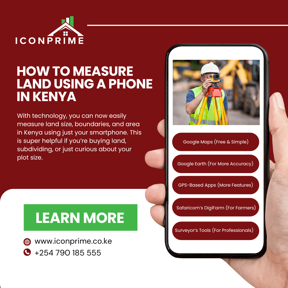
Technology has revolutionized land measurement, making it possible to measure land using a phone with accuracy. Traditionally, land measurement required professional surveyors using specialized equipment, but today, smartphones with GPS technology and land measurement apps can provide reliable results for real estate, farming, and construction projects.
Whether you are a landowner, property buyer, developer, or farmer, knowing how to measure land using the phone can help you estimate property size, verify boundaries, and plan developments efficiently. With mobile apps and GPS-based tools, users can measure land without expensive tools, making it a cost-effective and convenient solution.
In this guide, we will explore how smartphones can be used for land measurement, discuss the best apps available, provide a step-by-step measurement process, and highlight the advantages and limitations of mobile land measurement. By the end, you will know when to rely on smartphone measurements and when to hire a professional surveyor.
Why Use a Smartphone for Land Measurement?
Measuring land using a phone is convenient, cost-effective, and accessible. Below are some reasons why smartphone-based land measurement is becoming popular:
- Easy to Use: No specialized skills or expensive tools are needed.
- Cost-Effective: Eliminates the need for hiring professional surveyors for basic land estimations.
- Time-Saving: Allows for instant calculations without waiting for professional services.
- Portable and Accessible: Your phone is always with you, making it easy to measure land anytime, anywhere.
- Integration with Mapping Tools: Many apps allow users to save and share measurements for future reference.
Methods to Measure Land Using a Phone
There are three main methods for measuring land using a smartphone:
GPS-Based Land Measurement
- Uses Global Positioning System (GPS) technology to measure land size.
- Suitable for large-scale outdoor areas, such as farms and rural land.
- Requires a stable GPS signal for better accuracy.
App-Based Land Measurement
- Mobile apps use satellite imagery and manual marking of boundaries.
- Ideal for real estate buyers and landowners looking to verify property size.
- Works best in urban areas with clear boundary markers.
Satellite and Online Mapping Services
- Platforms like Google Earth and Google Maps allow for distance and area calculations.
- Requires an internet connection and works well for basic land size estimations.
Best Apps for Land Measurement on Smartphones
Different mobile apps are available for land measurement. Here are some of the best options:
| App Name | Features | Best For |
| Google Earth | Measures land size using satellite imagery | General land measurement |
| Geo Measure Area Calculator | Allows users to draw boundaries on a map to calculate the area | Landowners and real estate buyers |
| GPS Fields Area Measure | Uses GPS tracking to measure land size | Farmers and outdoor landowners |
| Planimeter | Provides detailed measurements for real estate projects | Developers and construction planners |
Each app has unique features, so users should select one based on their needs and required accuracy.
Step-by-Step Guide: How to Measure Land Using a Phone
Follow these steps to accurately measure land using your smartphone:
Install a Land Measurement App
- Download a reliable land measurement app from the Google Play Store or Apple App Store.
Enable GPS and Location Services
- Turn on your phone’s GPS function to enhance measurement accuracy.
Open the App and Select Measurement Mode
- Choose the appropriate measurement method:
- Walking mode – Walk around the land to record real-time measurements.
- Pin mode – Manually select boundary points on a satellite map.
- Choose the appropriate measurement method:
Measure the Land Area
- If using the walking method, start tracking and walking along the land boundary.
- If using the pin method, mark the land’s corners on the digital map.
Save and Export Measurements
- Save the recorded data for future reference.
- Export the map as an image or PDF to share with buyers, investors, or authorities.
Accuracy of Land Measurement Apps and GPS Technology
While smartphones provide convenient land measurement options, their accuracy depends on several factors:
- Satellite Signal Strength: Weak GPS signals in forest areas, mountains, or urban locations with tall buildings may reduce accuracy.
- Weather Conditions: Cloudy or stormy weather may disrupt GPS readings.
- Device Calibration: Ensuring your phone’s GPS is updated improves accuracy.
- User Precision: If using manual pin placement, accuracy depends on how precisely boundaries are marked.
On average, smartphone GPS has an accuracy of 3 to 10 meters, which is suitable for estimates but not legal documentation.
Advantages of Using a Phone for Land Measurement
- Affordable: No need for expensive surveyor tools, making it a cost-effective option for landowners and investors.
- Quick and Convenient: Instantly measure land without specialized training or equipment.
- Useful for Property Buyers: Helps verify land size before making a purchase decision, reducing the risk of fraud when considering land for sale in Kenya.
- Great for Farmers: Assists in measuring agricultural land for planting, irrigation, and farming activities.
- Supports Landowners: Helps check property boundaries and identify potential encroachments.
- Easily Accessible: Available on any smartphone, making land measurement simple and portable.
- Saves Time: Eliminates the need to wait for professional survey services for initial estimations.
- Allows Data Storage: Most apps allow users to save and retrieve measurements for future reference.
- Integration with Mapping Tools: Many apps sync with Google Maps and satellite imagery for enhanced accuracy.
- Ideal for Basic Planning: Useful for small-scale projects, home construction, and personal land assessments, making it easier for potential buyers to assess Kenya property for sale before committing to a purchase.
Limitations of Smartphone Land Measurement
- Not Legally Valid: Smartphone measurements cannot be used for official land registration or legal property transfers.
- Limited Accuracy: This may have minor errors compared to professional land surveying equipment.
- Requires GPS Signal: Poor connectivity in remote areas can affect reliability and precision, which may be a concern when evaluating property for sale in Kenya in rural locations.
- Not Ideal for Complex Boundaries: Works best for simple land shapes but may be inaccurate for irregular or hilly terrain.
- Dependent on App Capabilities: Accuracy varies between different apps, and not all offer advanced measurement features.
- Battery and Storage Usage: GPS and measurement apps consume significant battery power and may require large storage space.
- Weather and Environmental Factors: Cloudy conditions, trees, or obstacles can impact GPS signal strength, reducing accuracy.
- No Official Documentation: Measurements taken using a phone do not hold legal authority and must be verified by a licensed surveyor, which is critical for formal property investment in Kenya.
While smartphone land measurement is a great tool for quick estimations, it is important to consult a professional surveyor for official land transactions and boundary disputes.
When to Hire a Professional Surveyor?
While phone-based land measurement is useful, a licensed land surveyor is needed for:
- Legal land transactions require official documentation.
- Property boundary disputes with neighbours.
- Subdividing land for development or resale.
- Large-scale commercial land projects.
Conclusion
Using a smartphone for land measurement is an affordable and convenient method for real estate buyers, farmers, and developers. Learning how to measure land using a phone helps users estimate land size efficiently without requiring expensive survey tools. Apps like Google Earth, Geo Measure, and GPS Fields Area Measure provide quick and easy solutions for land measurement. However, accuracy depends on GPS signal strength, environmental conditions, and device calibration, so phone-based measurements should be used for estimation purposes only.
For legal property transactions and official surveys, hiring a licensed land surveyor is recommended to ensure accurate boundary definitions and compliance with regulations. By combining technology and professional expertise, landowners and investors can make informed property decisions, avoid disputes, and plan developments effectively.
Frequently Asked Questions
Can I measure land using my phone accurately?
Yes, smartphones can provide reasonably accurate land measurements, but accuracy depends on GPS quality, environmental conditions, and app calibration. Areas with strong GPS signals and clear surroundings yield better measurement results. However, for precise legal measurements, a licensed surveyor is recommended.
Which is the best app to measure land size?
Several apps are available for land measurement, but some of the best include Google Earth, Geo Measure Area Calculator, and GPS Fields Area Measure. These apps provide reliable tools for estimating land size, marking boundaries, and measuring distances efficiently.
Is smartphone land measurement valid for legal transactions?
No, smartphone-based land measurements are not considered legally valid for official property transactions. While they are useful for estimation and planning, only a professional land surveyor can provide the certified measurements required for legal documentation and land registration.
Can I measure land offline using my phone?
Some land measurement apps allow offline usage, enabling users to measure land without an internet connection. However, accuracy improves with real-time GPS access, as satellite positioning ensures precise measurements and correct boundary markings.
How does land measurement help in property investment?
Land measurement is essential in property investment as it helps buyers and investors verify land size before purchasing, ensuring that they get the correct property dimensions. It also prevents fraudulent transactions, helps in planning land development, and allows investors to compare multiple properties before making decisions.